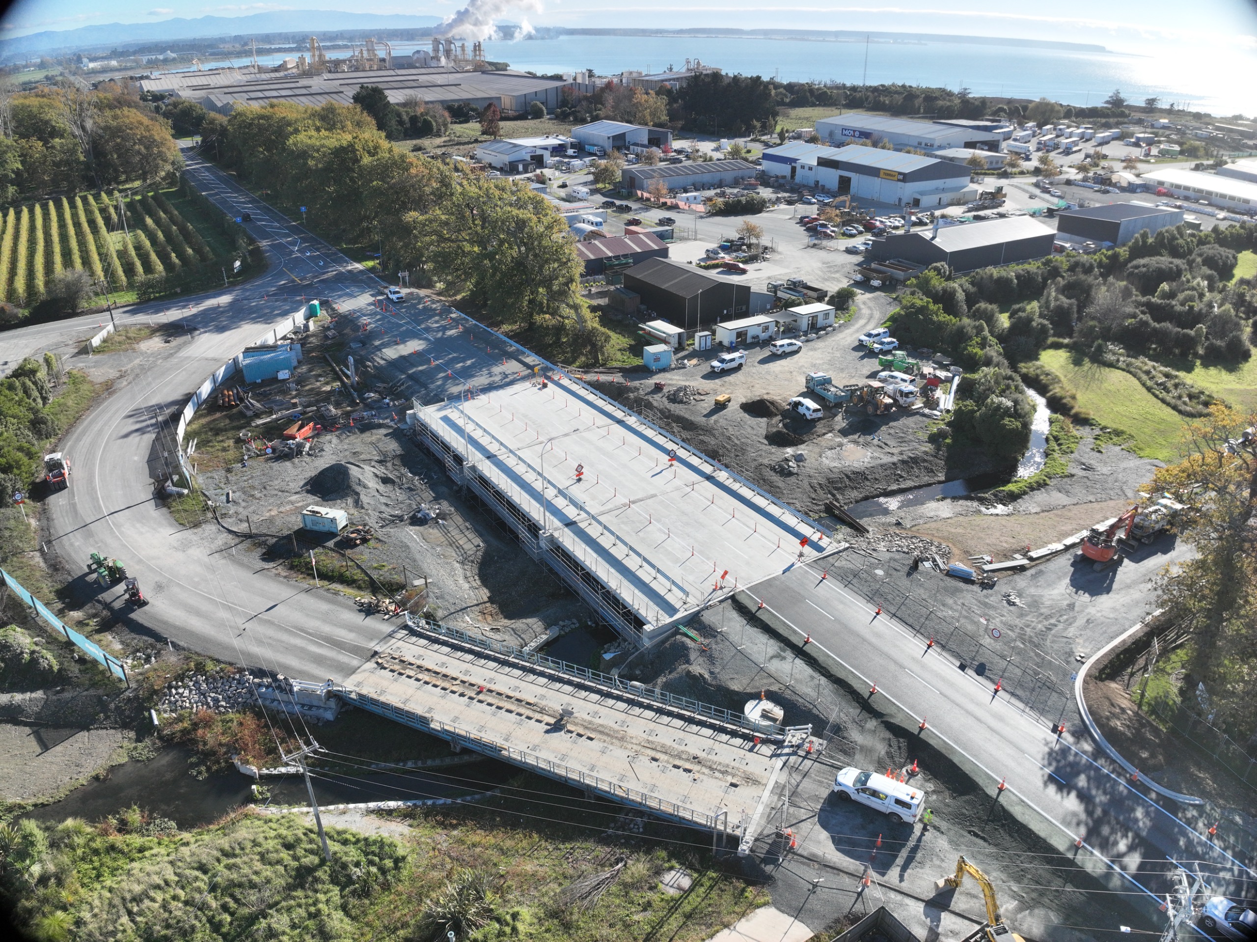
First vehicles use new bridge
18 May 2026
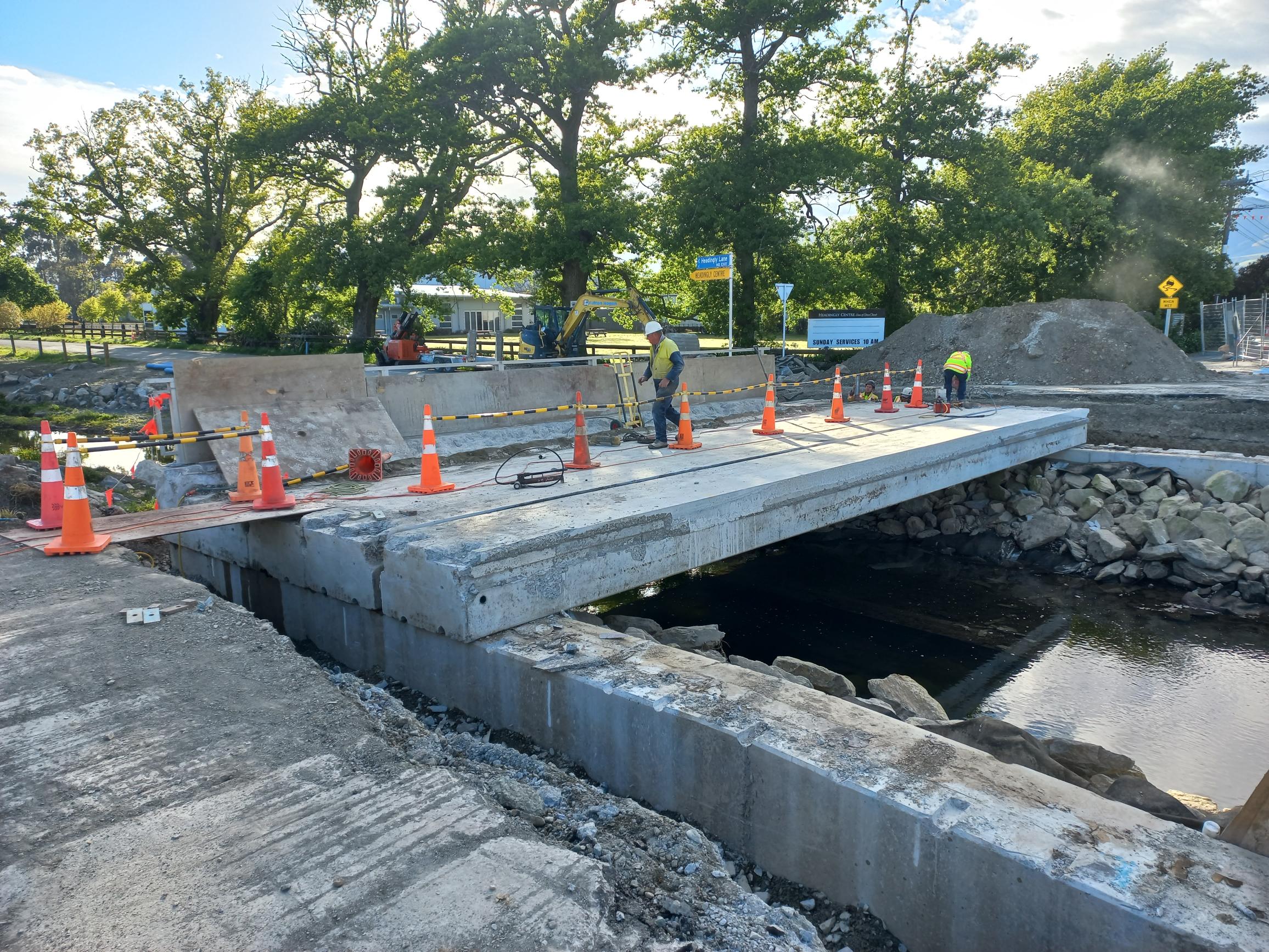
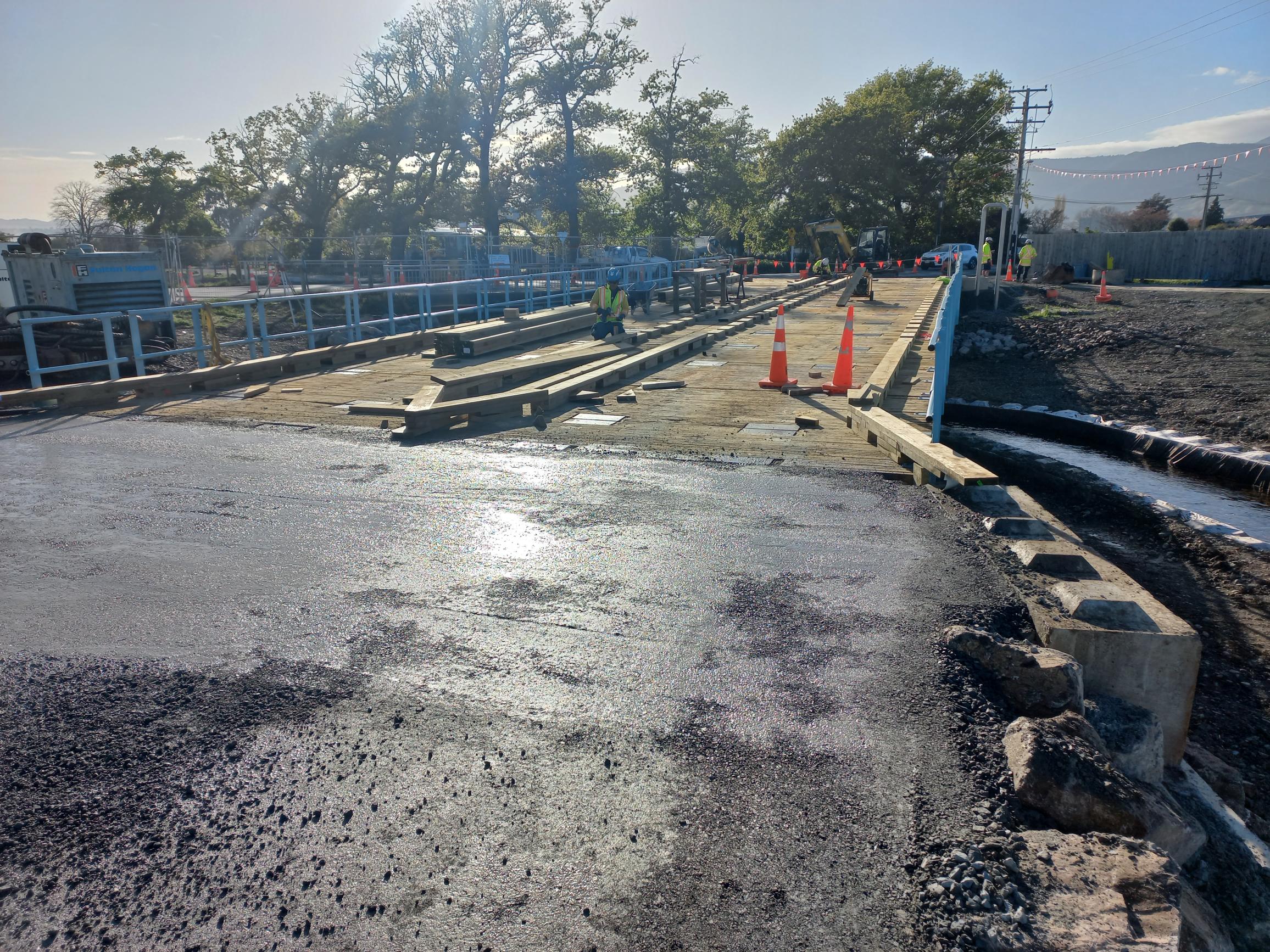
The "Super Weekend" of work on the new Lower Queen Street bridge was a massive success.
Our contractors worked in shifts from 7.00pm Friday night until late on Sunday afternoon to prepare the bridge for vehicles.
At this stage traffic is being directed across the new bridge, under temporary traffic management with a 30km/h temporary speed limit. Vehicles are running on the northern side of the bridge.
A mix of asphalt and chipseal surfacing has been used to open the bridge, however, this will not be the final surface. The final layer of asphalting will be done in about four or five weeks; this will be done during a couple of night closures.
Now the crew's attention has turned to deconstructing the bridge on the temporary bypass road with a new crane coming in at the end of the week.
We'll start the downstream earthworks at the end of this week.
The project is now forecast to be completed by mid-July.
Click image to enlarge
Full road closure for weekend 15 - 18 May
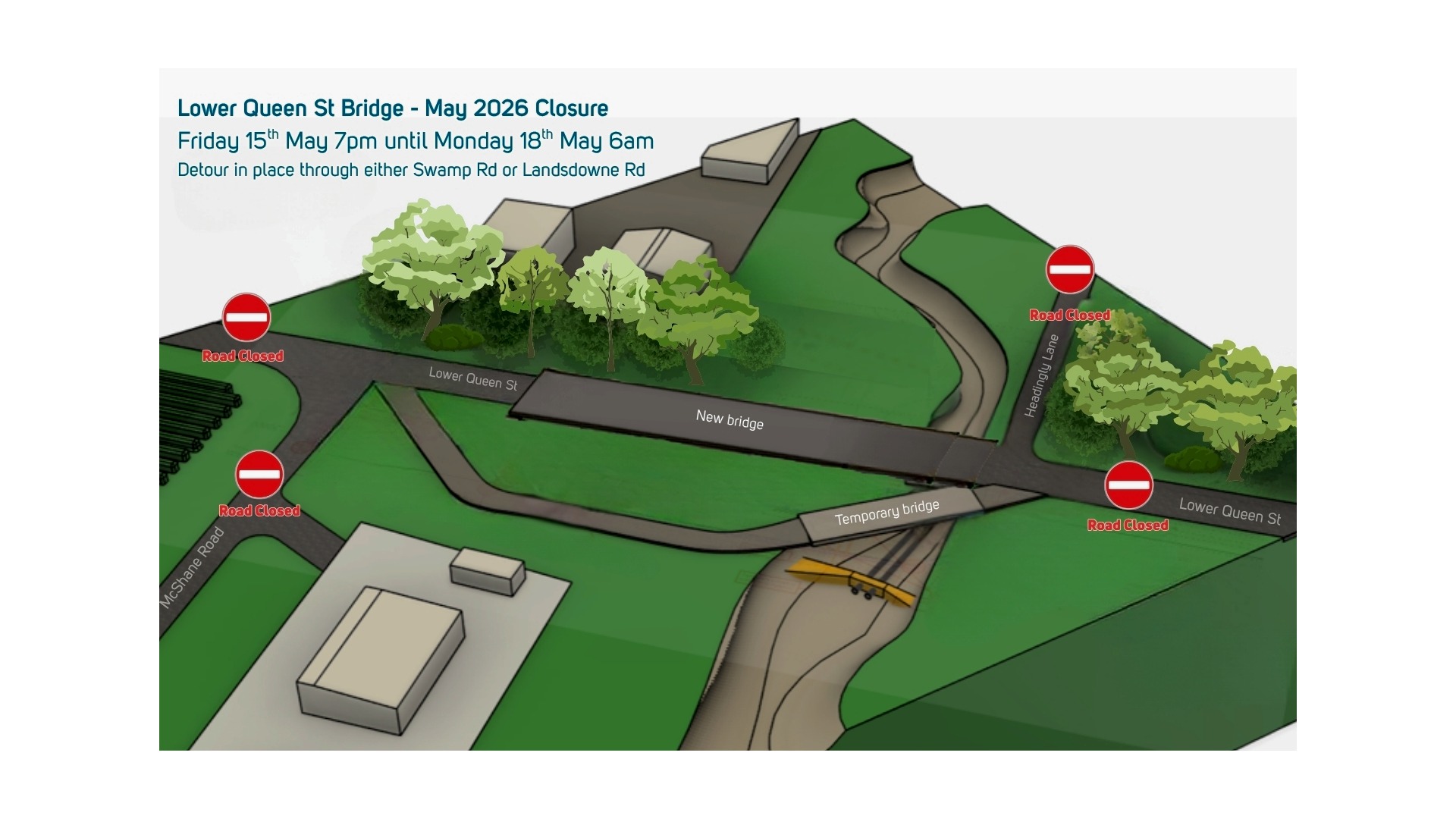
As the Lower Queen Street bridge project moves towards the finish line, we need to close the road completely for one big weekend of work.
This will happen from 7.00 pm Friday 15th May to 6.00 am on Monday 18th May. Lower Queen Street will close from the Arvida Waimea Plains Village entrance to Sandeman Lane. This means there will be no access to McShane Road from Lower Queen Street. Headingly Lane will remain closed till project completion, forecast for mid-July.
Vehicles wanting to access or exit the Artillery Place industrial area and Nelson Pine Industries will need to use Swamp or Landsdowne Roads.
Click here to see full details
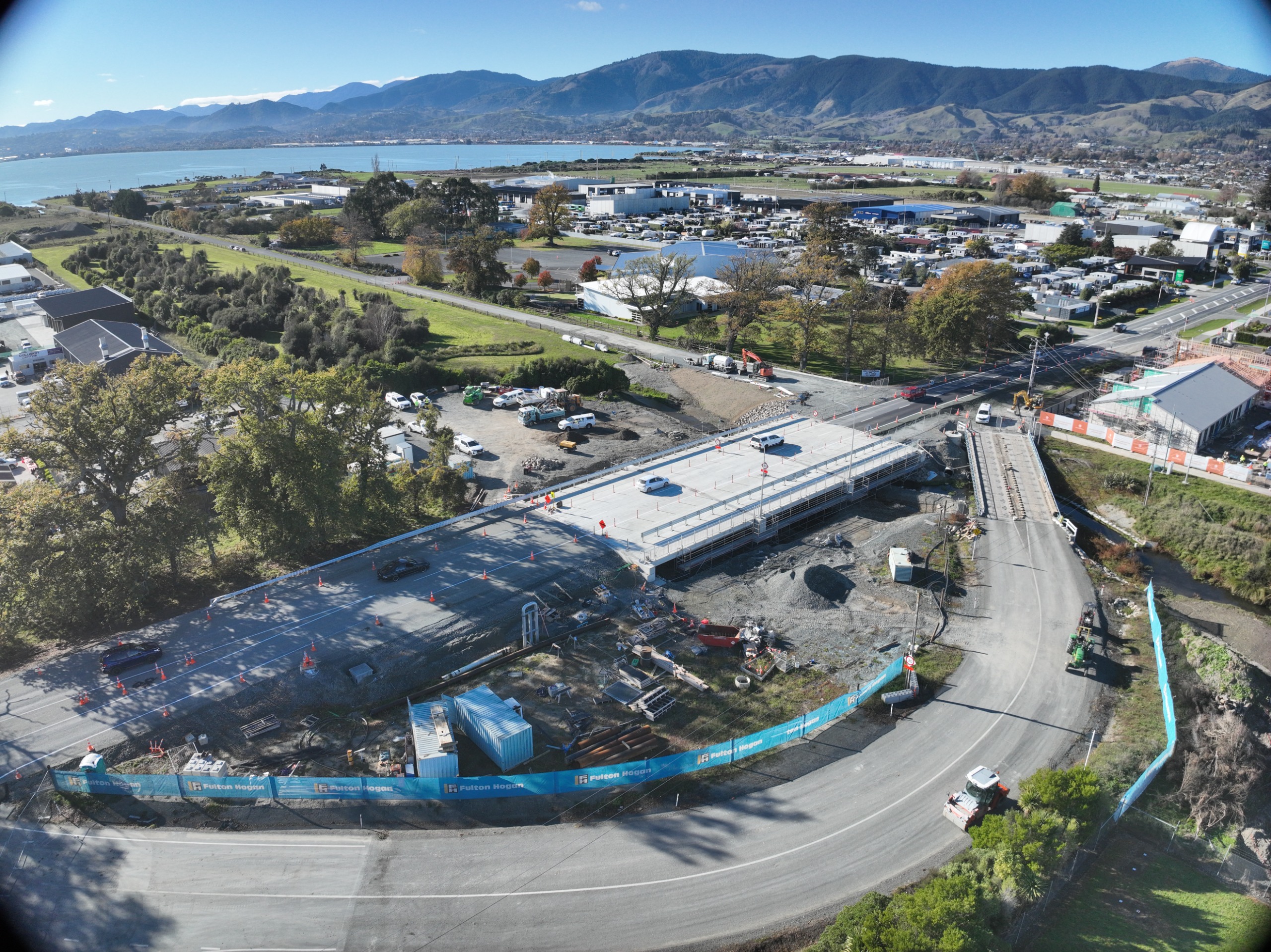
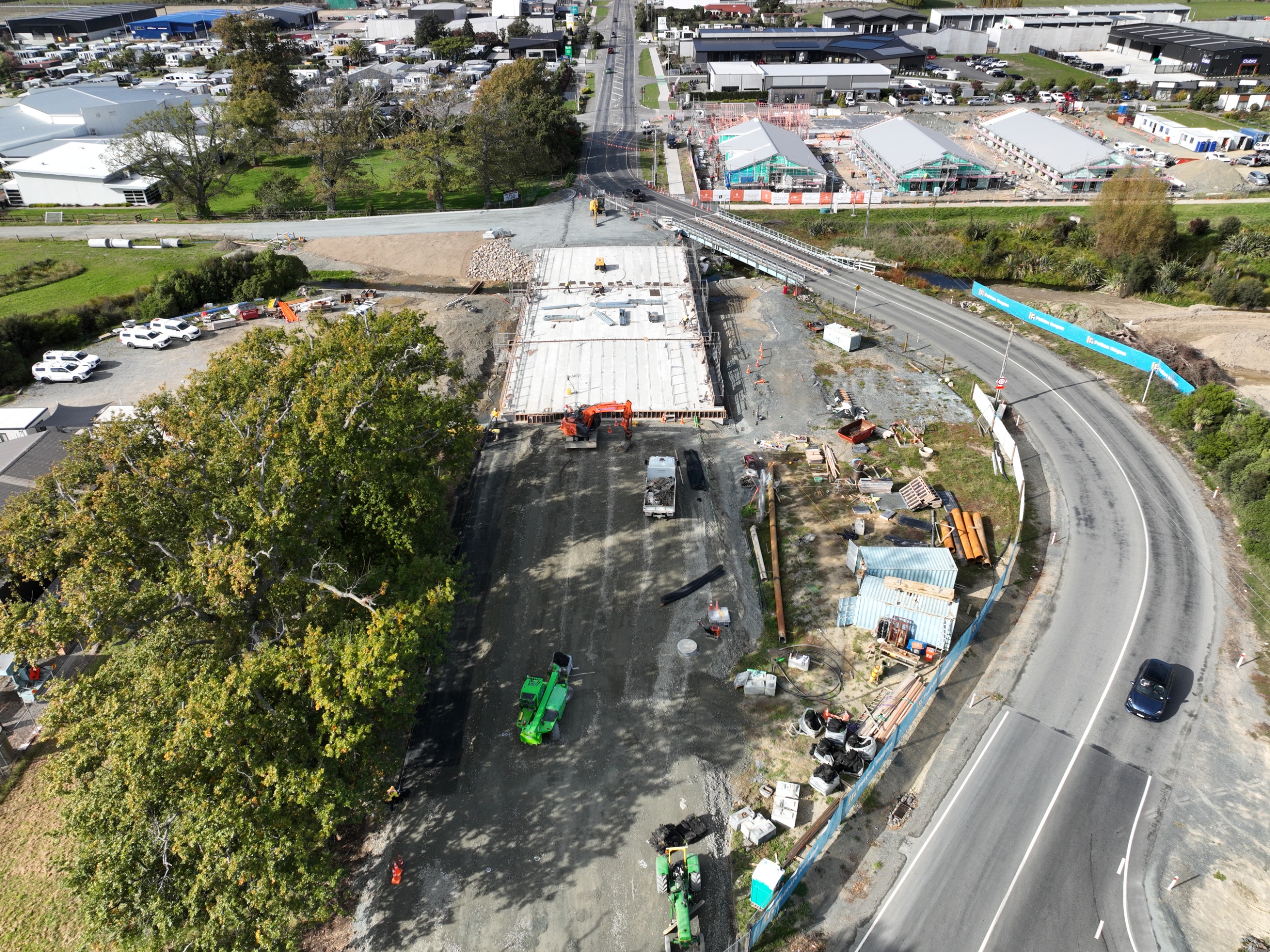
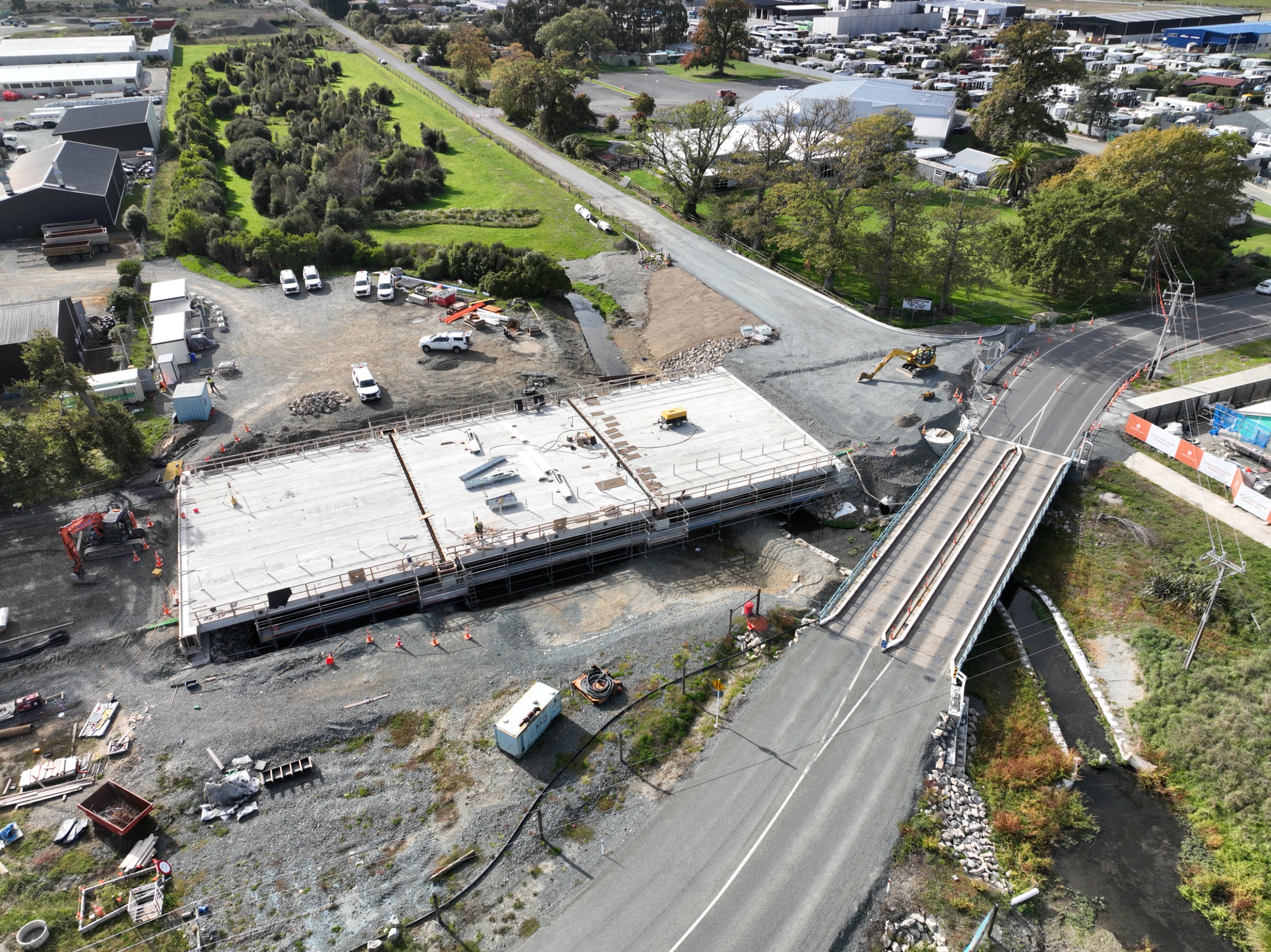
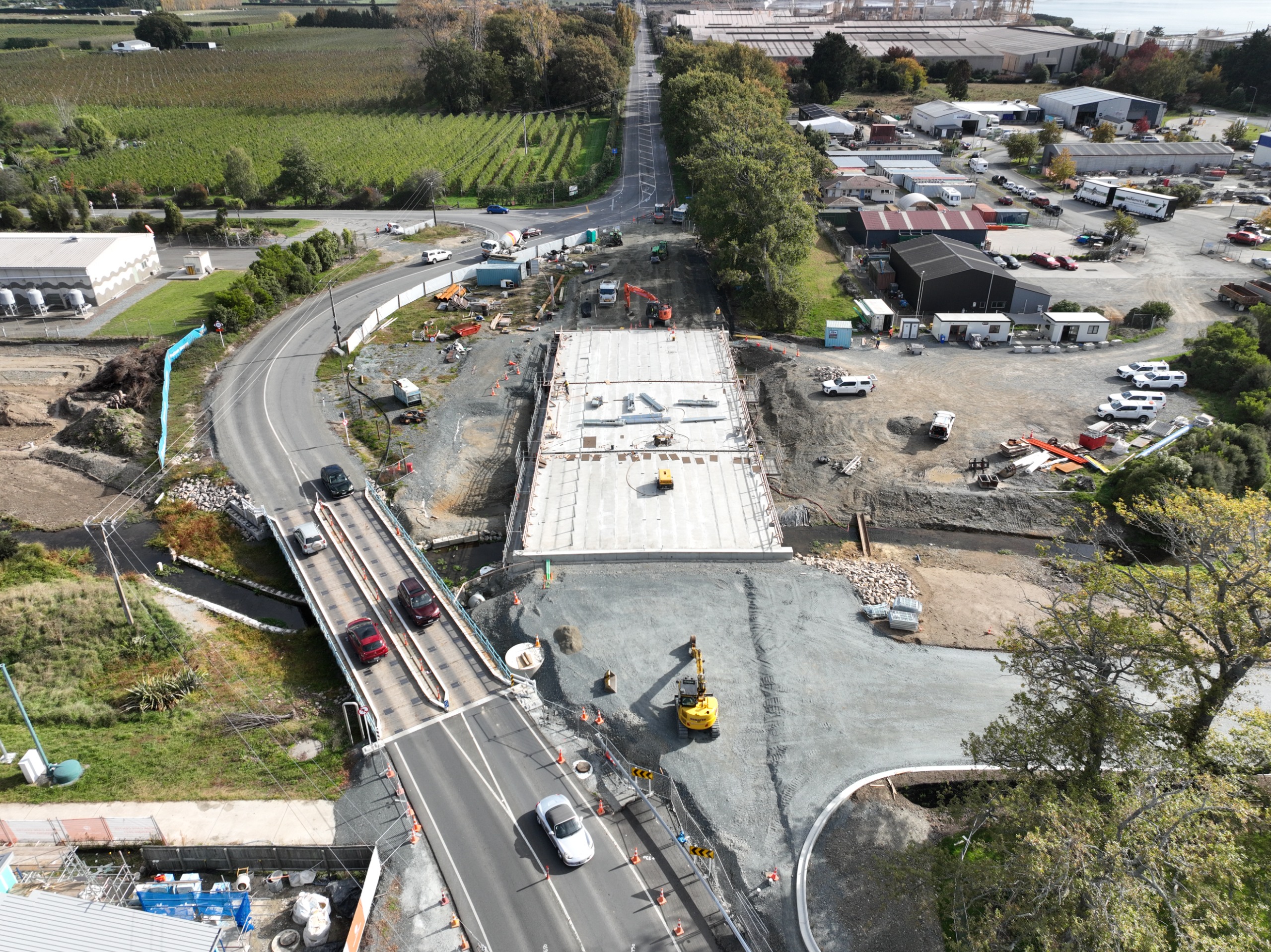
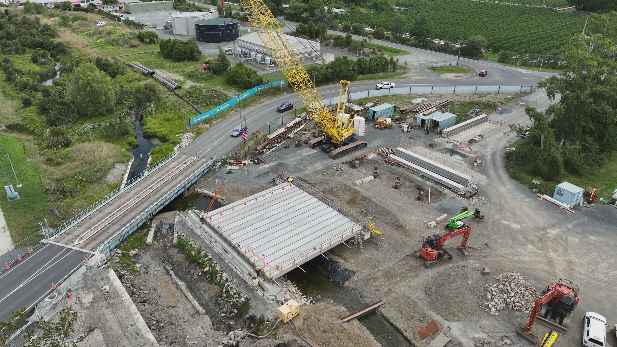
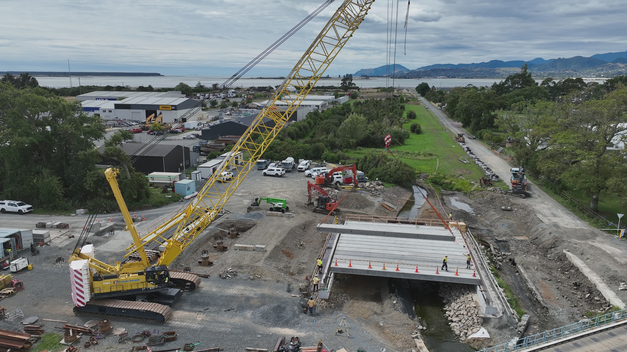
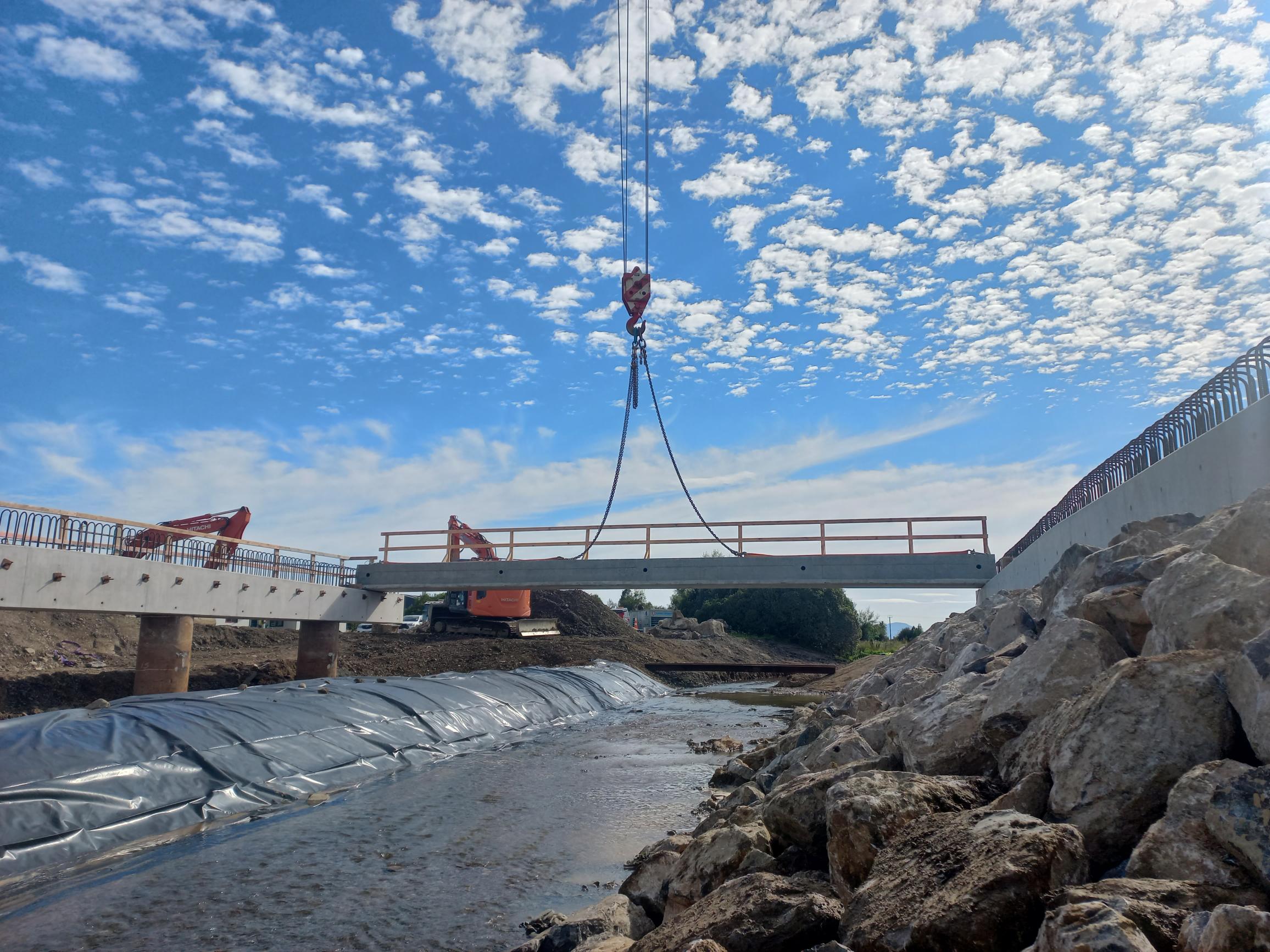
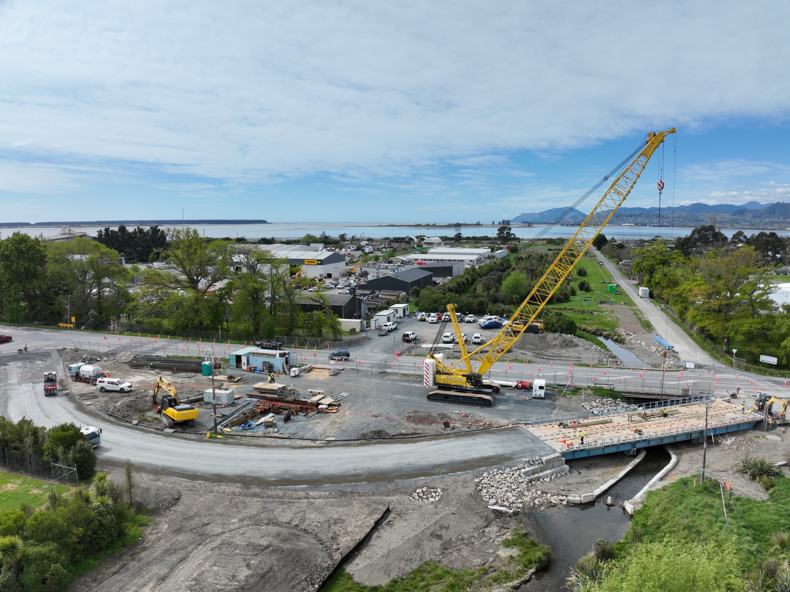
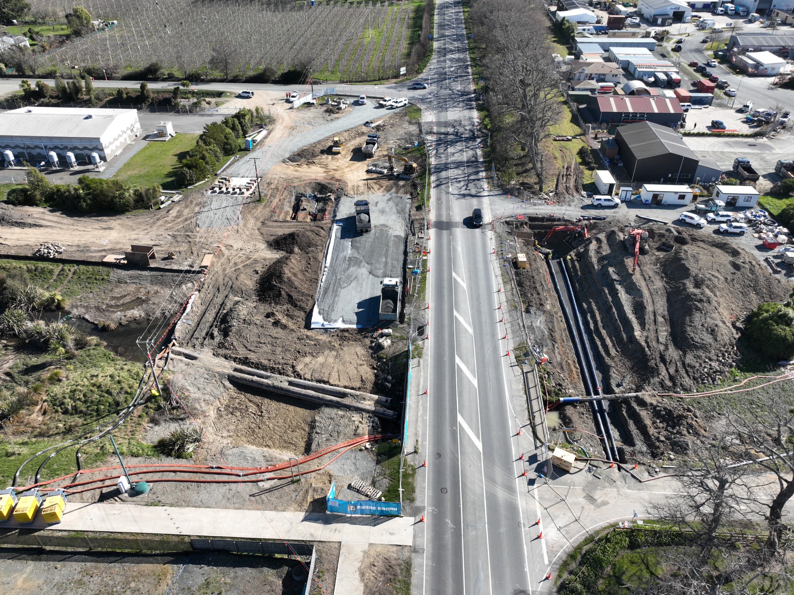
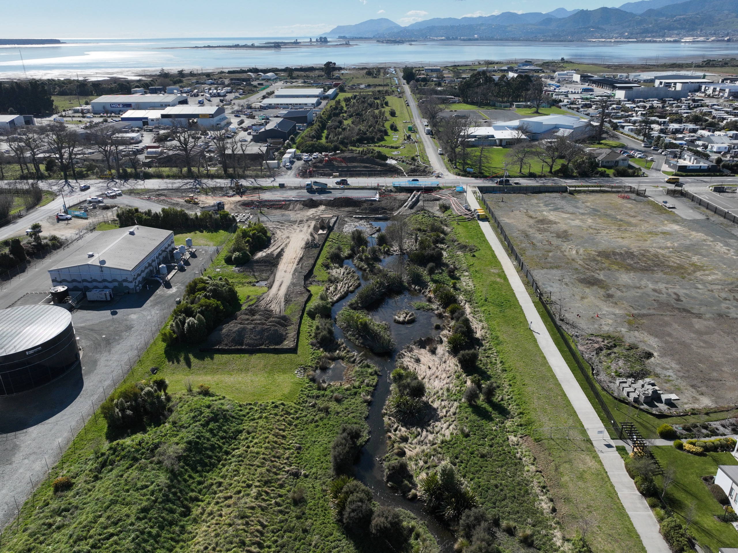
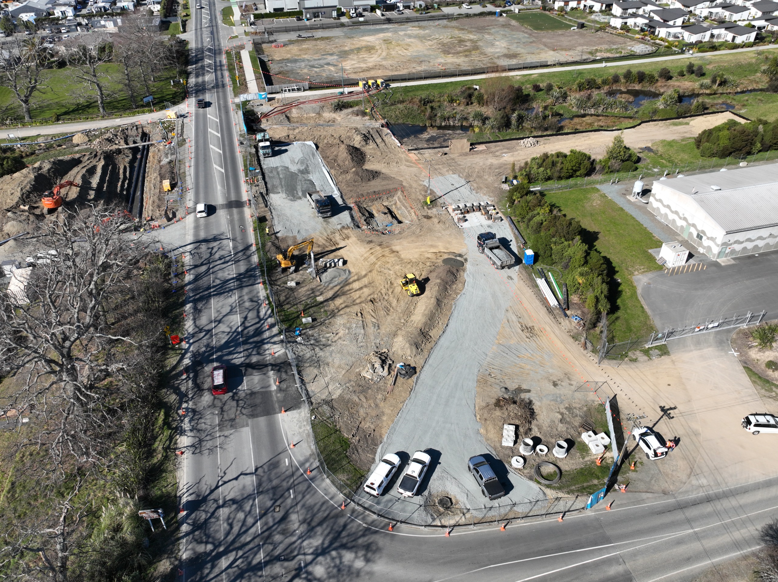
Latest drone images of the construction site
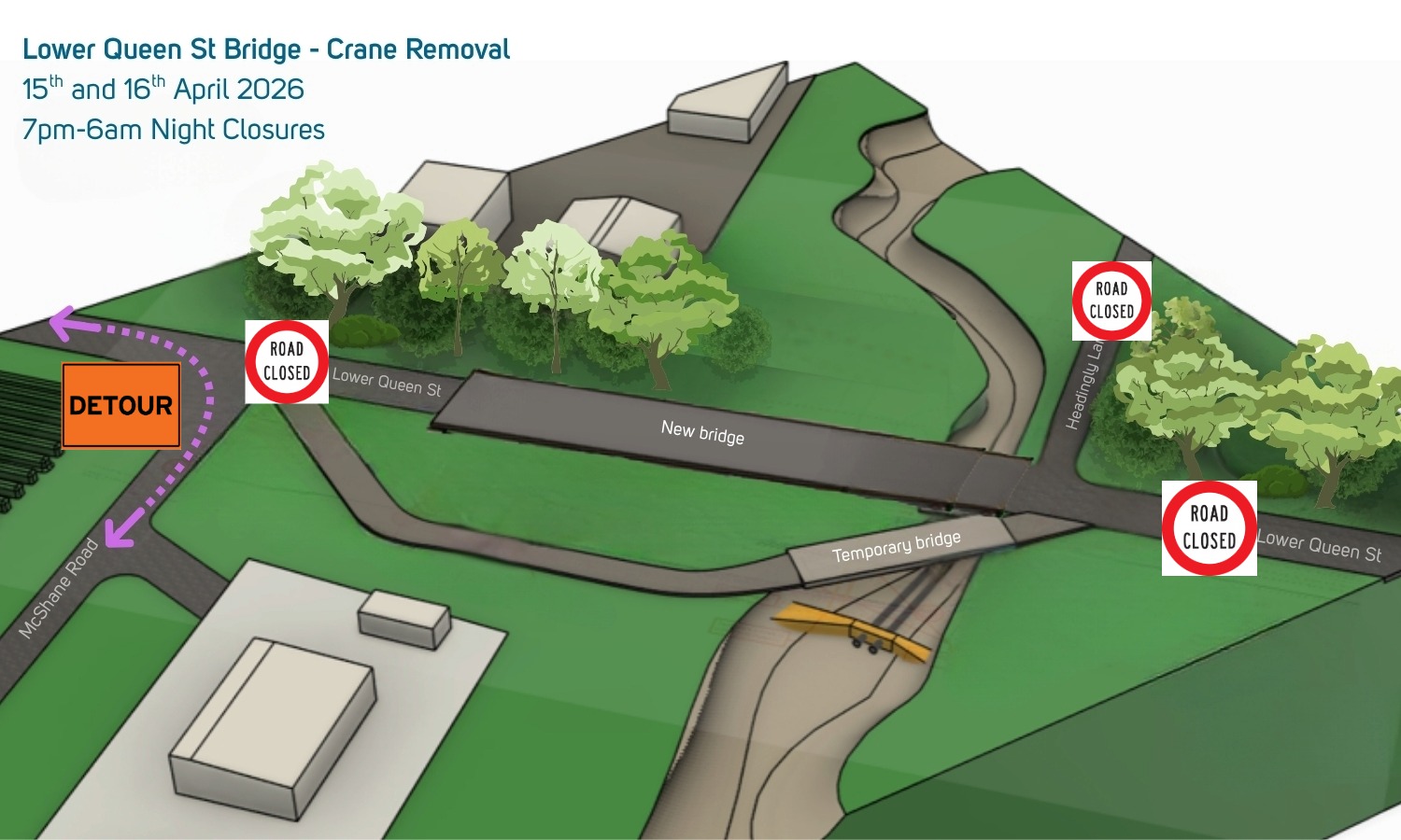
Overnight road closures in April
With the Lower Queen Street Bridge upgrade heading toward its final phase we want to let you know about an upcoming night road closure.
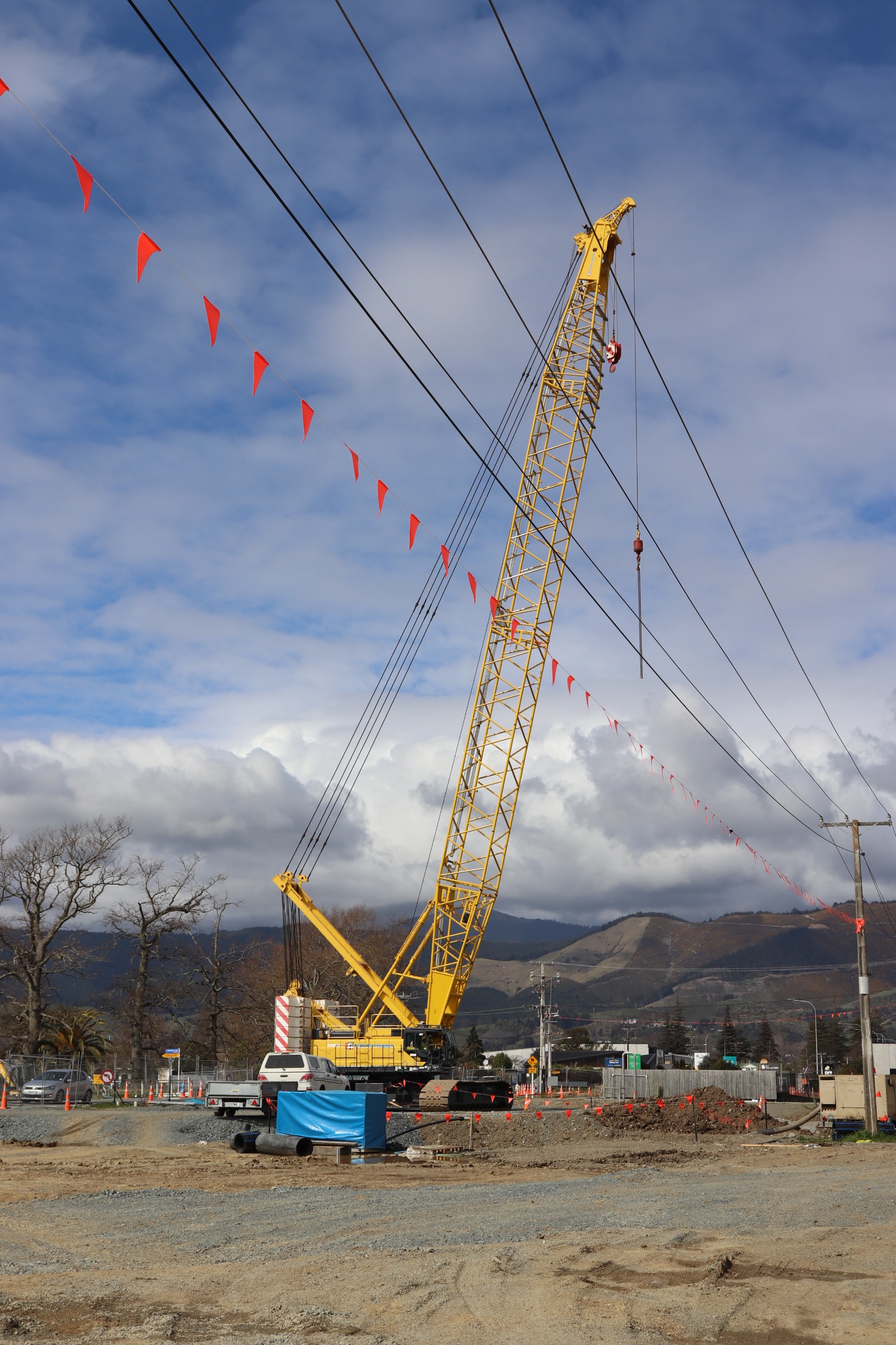
The large crawler crane, “Captain Hook” needs to be dismantled so it can be trucked to its next job further south but to o this we will need to close the temporary bypass road for two nights.
The work is scheduled for the nights of Wednesday 15 April and Thursday 16 April when Lower Queen Street from the Arvida Waimea Plains Village entrance to the intersection of McShane Road will be closed to all traffic. See the diagram below.
Traffic management will be in place and the entrance to the village will remain open with all other vehicles detouring along McShane Road.
Night closures will be from 7.00pm till 6.00am the following day.
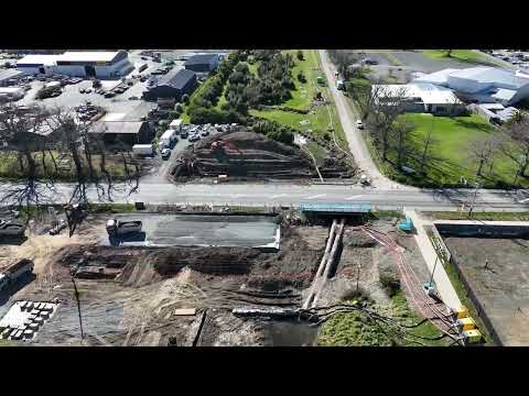
Bridge takes shape
Listen to the February project update.
There’s been a lot of activity on Lower Queen Street in Richmond since May last year with the Lower Queen Street Bridge Capacity Upgrade project.
The old bridge was about 14 metres long and being replaced by a new 48-metre-long structure which will allow the channel under it to be widened.
The project has a budget of around $11.5 million and is running ahead of schedule.
Darryn Palmer spoke to Tasman District Council Project Manager Jack Cerfontaine about this massive job.
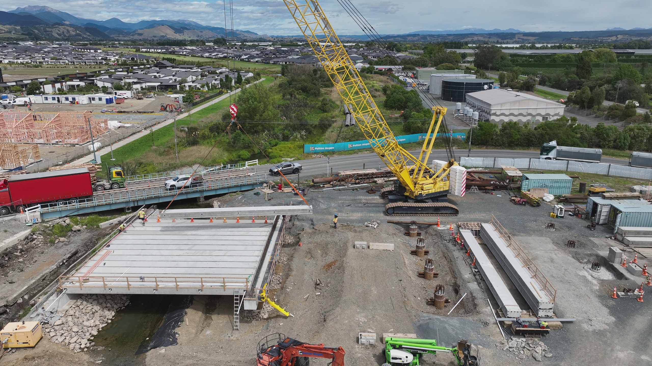
Beams going in
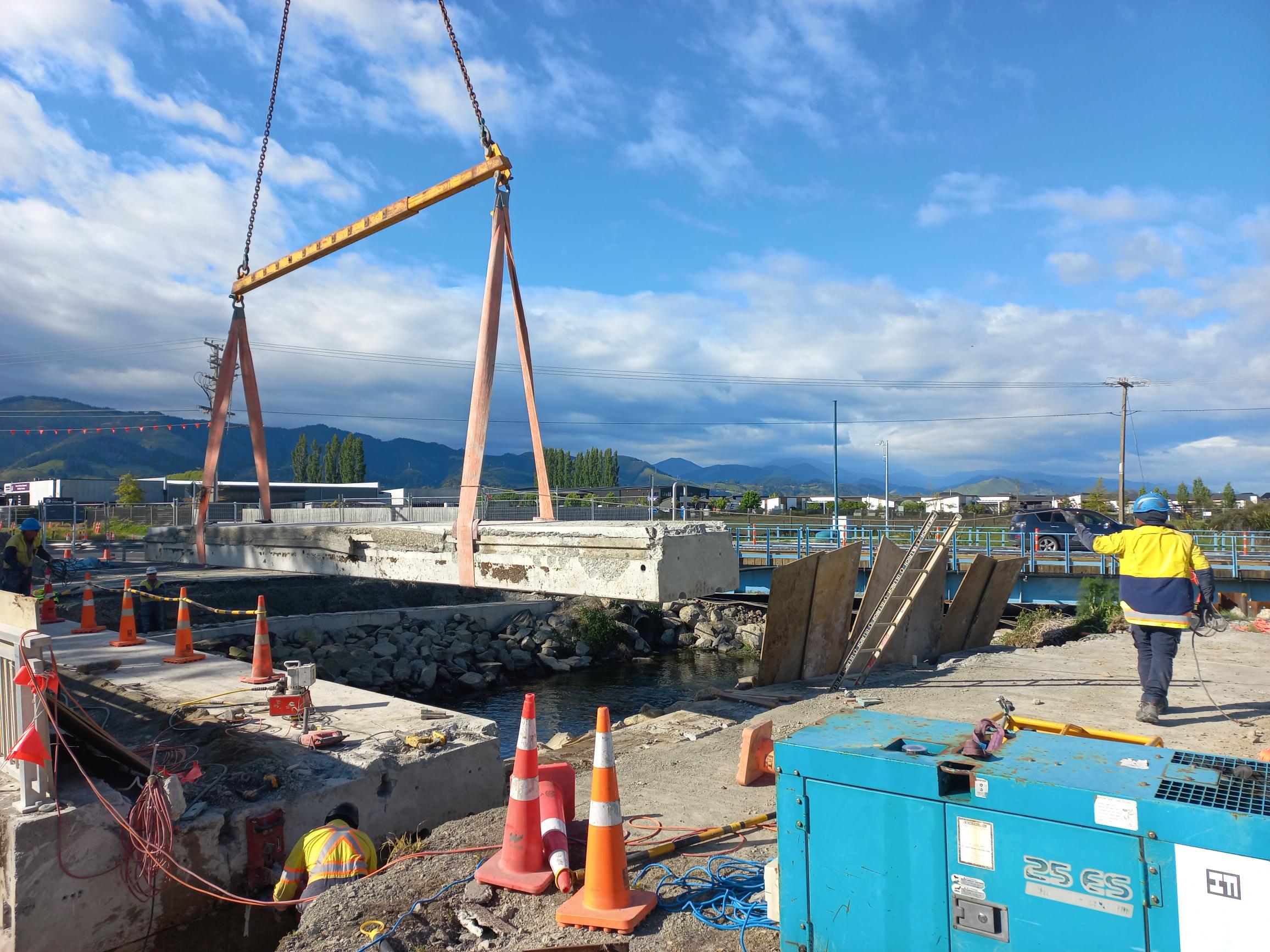
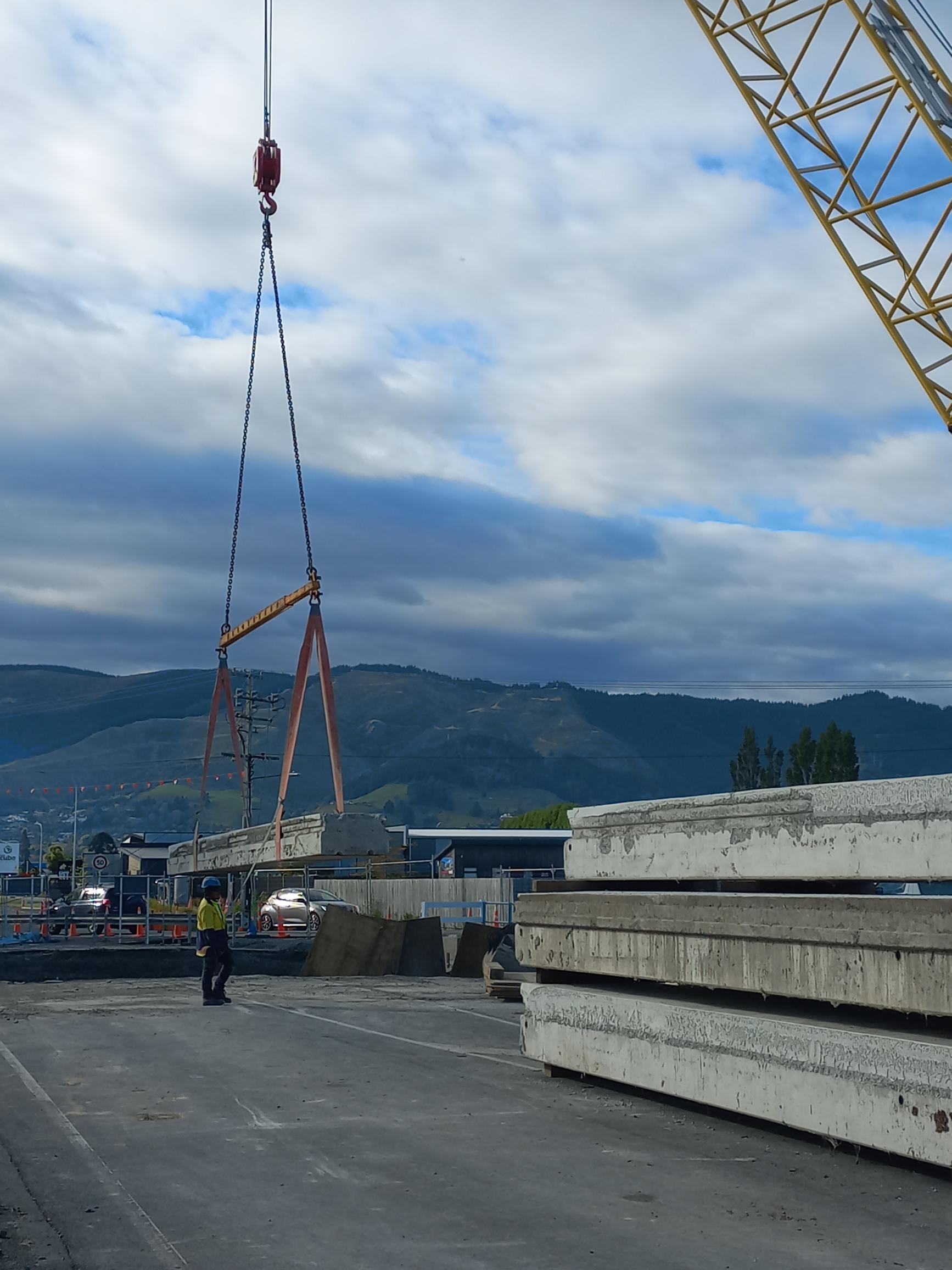
We have now installed the first of 51 beams to go across the Lower Queen Street Bridge. These beams span between the bridge supports and carry the weight of the deck, vehicles, and pedestrians, transferring loads safely down into the foundations. This is a key milestone in the build, because it establishes the bridge’s shape and strength and allows the next stages of work, such as deck construction and surfacing.
First beam being lifted into place by Captain Hook.
Merry Christmas and happy holidays
The bridge replacement project is on track and progressing well and our team is packing up the tools and will be off site for a well-earned holiday and will be back on the job from Monday 05 January.
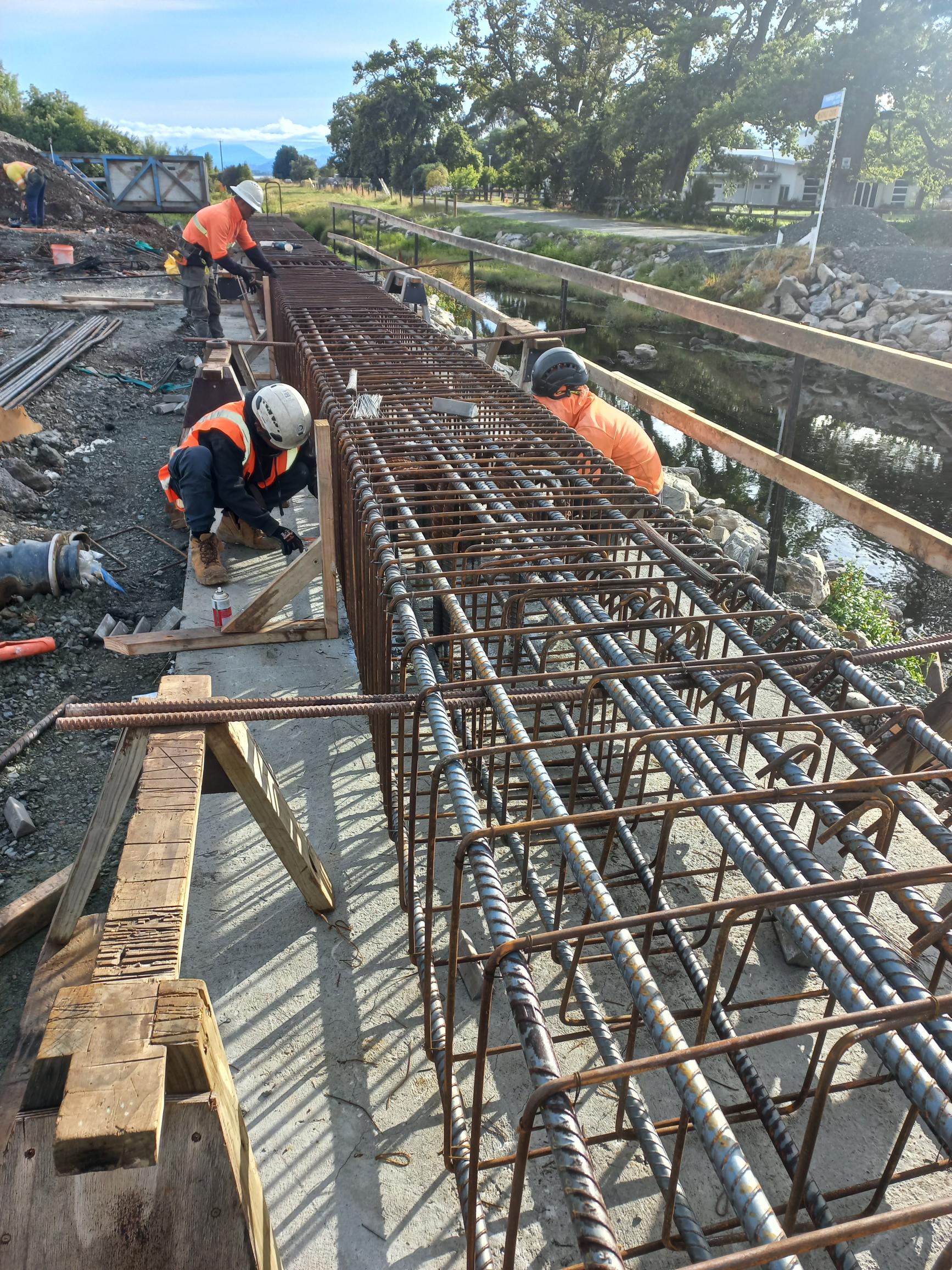
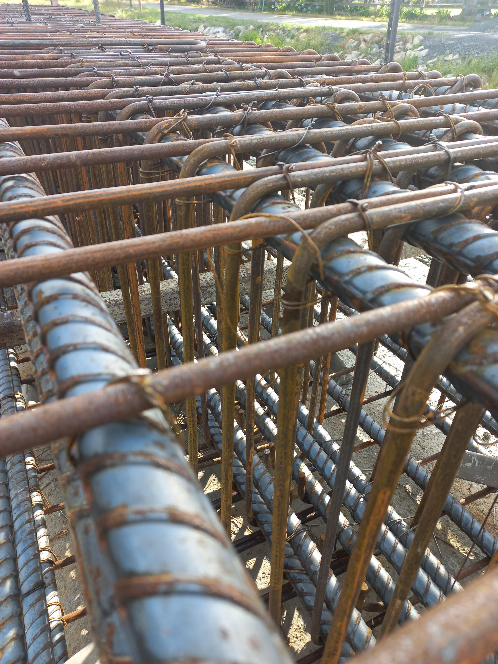
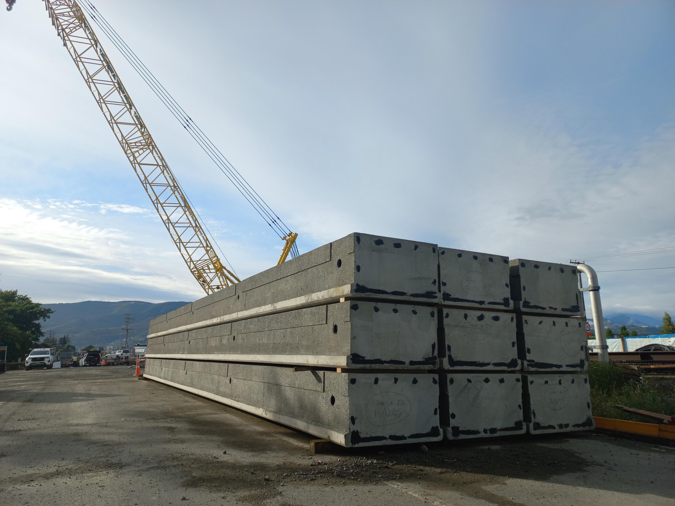
In pictures below you can see the reinforcing steel for the eastern abutment of the bridge being tied in, and the first nine bridge beams that have been delivered to the site.
Click on images to enlarge
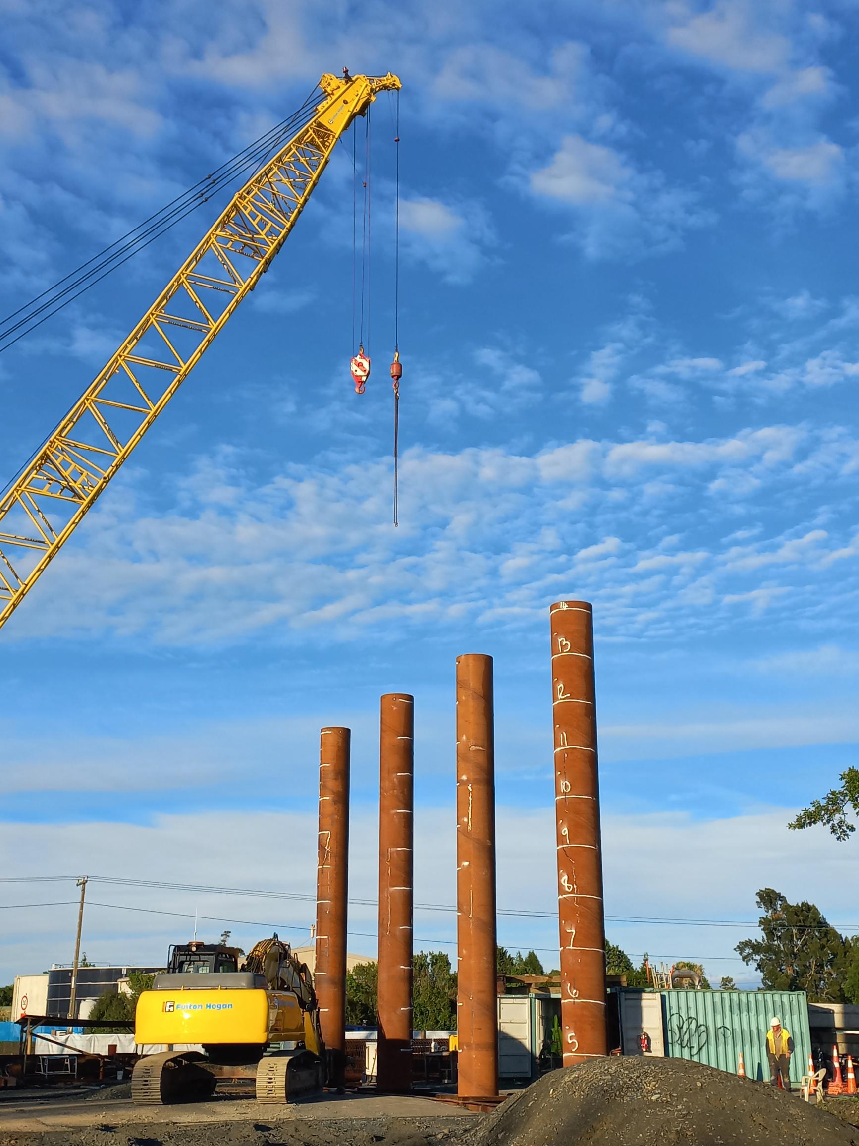
Piles driven
17 November 2025
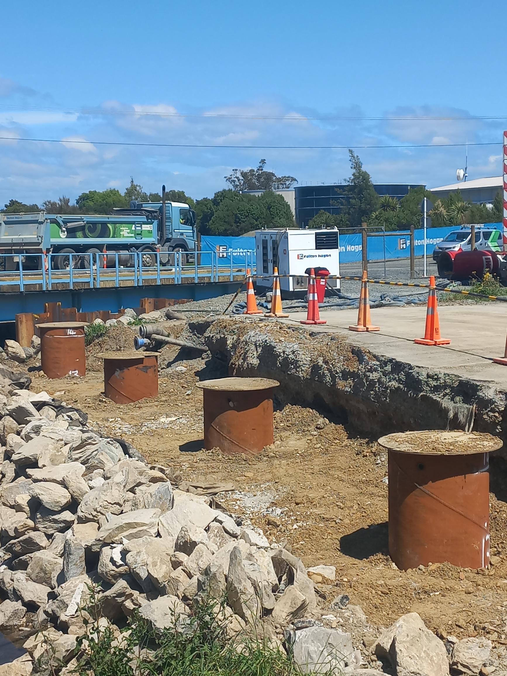
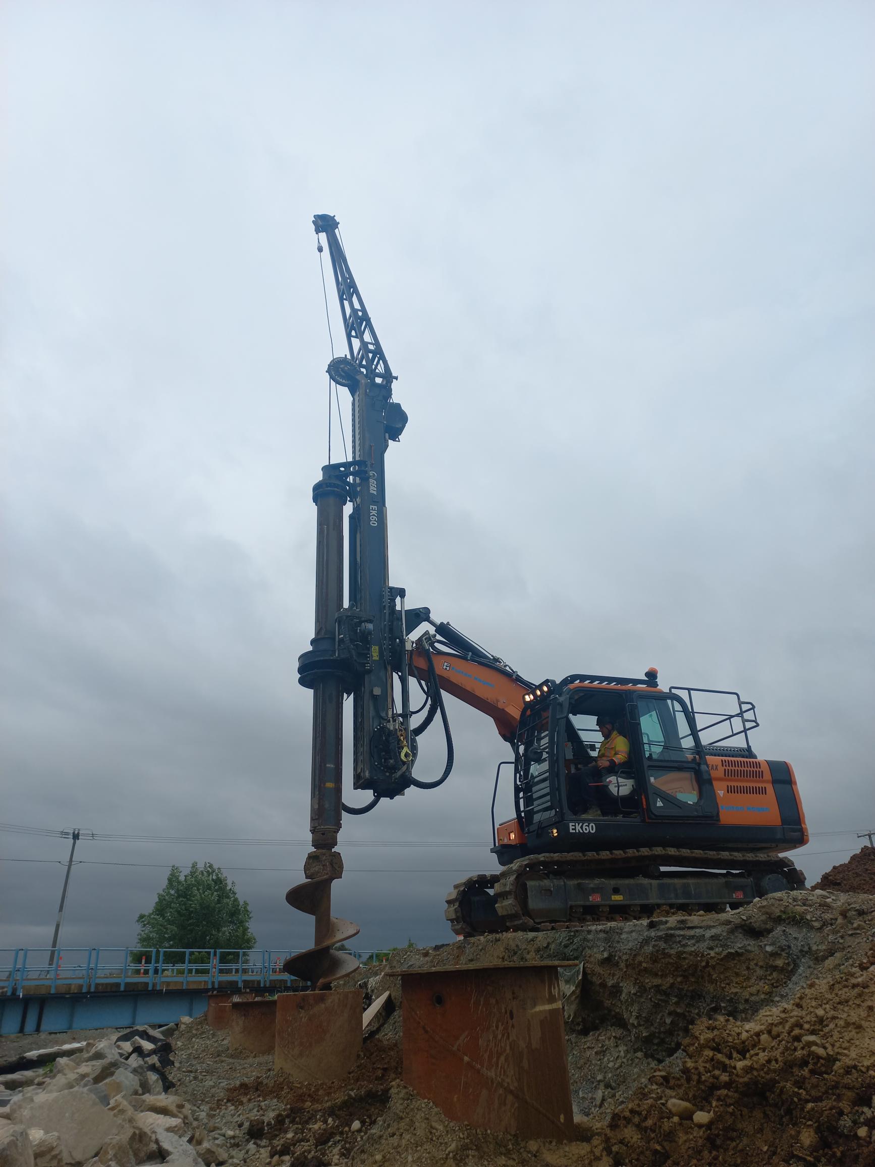
Over the past few weeks there's been a lot of action on site with the piles for the new bridge being driven into the ground.
16 piles, each 14 metres long, have been hammered into the ground. These are part of the foundations for the new 48-metre-long structure.
The steel piles are basically open-ended pipes and the over the next few months the soil that entered the piles during the piling process will be augured out, then they'll be prepared with the installation of reinforcing steel before being filled with concrete.
Click on images to enlarge
Out with the old - In with the new
30 October 2025
The project is progressing well with the old bridge demolished and pile driving for the new structure underway.
While we’re piling there will be some noise and vibrations at times, like when we drove the piles for the bypass bridge.
The piling work will be done only during the day on weekdays and the occasional Saturday – it won’t be constant and will take about three months.
See the demolition progress pictures below - Click to enlarge.
The new bypass road is open
The new bypass road opened at dawn on October 22 2025.
New Bypass road under construction.
Click image to enlarge

The big guy rolls into town
Work is taking shape on the Lower Queen Street Bridge replacement, and we’ve just welcomed some impressive machinery to help us along the way.
The new bridge will be bigger and better, designed to let water flow more freely during heavy rain and help reduce the risk of flooding.
It’s been a busy few weeks on site. Crews have already relocated three large sewer pipes, along with two raw water lines and a water main. Raw water is the water that comes from the main bore before it gets treated.
Work is also progressing well on the construction of the temporary bypass road.
The real star of the show arrived last week – a massive 250-tonne crawler crane. This giant piece of equipment will take care of the heavy lifting, driving piles deep into the ground for the temporary bridge on the bypass road, and then moving on to the new permanent bridge. It arrived in pieces on nine truck and trailer units and rebuilt on site.
Piling work will be underway for two to three months leading up to Christmas, and while it will be a bit noisy at times, it’s an exciting sign of progress.
The big kid on the block!
Overnight road closures and piling noise
Work is ramping up on the site of our Lower Queen Street bridge replacement with the arrival of a massive piece of equipment.
Our main contractor, Fulton Hogan, is bringing a 250-tonne crawler crane onto site by nine trucks and will be erected on an especially strengthened pad. (Picture on next page)
We need to close Lower Queen Street overnight next Wednesday 3 September from 6pm till 6am the following morning for erection of the crane.
The road will need to be closed again, the following night, Thursday 4 September as we realign two large water mains.
During the overnight closures vehicles will need to use the same detour route as previously, along McShane Road.
The giant crane will take care of the heavy lifting, driving piles deep into the ground for the temporary bridge on the bypass road, before moving on to piling the new permanent bridge.
The piling work will be underway for two to three months leading up to Christmas, and it will be a bit noisy at times, but if everything goes to plan, we will be opening the temporary bypass road in October.
Further Lower Queen Street night closures
08 October 2025
We’re about to mark a significant milestone in the project to improve Borck Creek bridge on Lower Queen Street, the opening of the temporary bypass road.
But to get the final touches done, there will be further overnight road closures before we open the temporary bypass road around the main construction site.
To install a watermain, which is the final re-alignment of the underground water and wastewater services, we need to shut the road between 6.00pm on Tuesday 14 October and 6.00am the following morning.
The overnight closures on Wednesday 15 and Thursday 16 October will also include the LQS-McShane Road intersection. This means vehicle access between Lower Queen Street and State Highway 6 will be via Swamp or Lansdowne Roads.
The following week, on Tuesday 21 October there will be overnight work on the site between 6.00pm and 6.00am to complete road marking and the realignment of electrical cables. The road will not be fully closed and there will be stop/go traffic management.
The new bypass road will open to traffic at 6.00am on Wednesday 22 October.
On Wednesday 22 and Thursday 23 October there will be further night work under stop/go traffic management to put finishing touches on this phase of the project.
Once this work is finished the construction team will turn their attention to building the new bridge.
Site photos and video August 2025 - click image to enlarge
Little bridge gets a big upgrade
Many people probably don’t realise it, but there’s a small bridge on Lower Queen Street, a small bridge that is about to get a major upgrade.
Borck Creek runs under the Lower Queen Street bridge next to Headingly Lane, but it’s not wide enough to pass sufficient stormwater flow. The new larger bridge will ensure water can flow away better during heavy rain, reducing the risk of flooding with further work being done downstream to widen the channel out to the estuary.
The current bridge is about 14 metres long and is to be replaced by a new 48-metre-long structure which will allow the channel under it to be widened.
The project has been planned for several years and has a budget of around $11.5 million. It will take up to 14 months to complete.
Lower Queen St Bridge flyover
Why is this work needed?
Borck Creek is one of the critical watercourses in the Richmond catchment serving a 1,400-hectare catchment area. It has gone through a significant journey of planning to secure a corridor not only for the use of stormwater relief but also providing public amenity and ecological value.
The Borck Creek development is a long-term project. Currently this small bridge creates a bottle neck in this part of the stormwater network. The new longer bridge is vital to ensure large volumes of accumulated water can easily and quickly flow out into the Waimea Estuary in a large flood.
August 2022 weather event


Bypass road route
The temporary slip road around the construction site will meet full road construction standards to provide a quality surface for all users, including heavy vehicles.
There will be full entry to Pinnacle House at all times.
The image below shows the bypass route. Click on image to enlarge.

The blue line is an indication of where the bypass road will go. The other blue line shows the extension of Saltmarsh Lane to provide access to Headingly Lane.
Traffic management
There will be a couple of short periods when the road will still need to be closed during the construction phase. Where feasible, we will schedule these outside peak hours.
We will share any road closure information via the Antenno app – download it for free from the app store on your phone.
You can also click the follow button in the banner at the top of this page to receive updates.


